Product overview
BREVA reflexa micro (“reflexa micro”) measures the distance between a GNSS antenna and a nearby water surface — and therefore the water level — by listening to how satellite signals reflected by the water interfere with the direct signal. No part of the instrument touches the water: it is mounted on a wall, a pole, a bridge parapet or a lake-side railing a few metres above the surface, with the antenna looking at the open sky and at the water.
It is a small, solar-powered unit built on the TAHMO WLM V1 board (RP2350 microcontroller, u-blox SAM-M10Q multi-GNSS receiver, Ground Control RockBLOCK 9704 Iridium modem). The unit records the satellite signals, computes the water distance on board, stores the results and sends a compact summary over the Iridium satellite network, so it works where there is no mobile coverage and no mains power. A reflexa micro unit does one job: water level by reflectometry.
reflexa micro comes from the TEMBO Africa project, where TU Delft, TAHMO and GReD are partners: the hardware is TU Delft’s and TAHMO’s (the TAHMO WLM, also known as TIGIR), the firmware and the field console are GReD’s. See where the hardware comes from.
A desktop application, the BREVA reflexa micro field console (macOS, Windows, Linux), installs, configures, verifies and maintains the unit over USB, and lets an operator watch the reflections live on site.
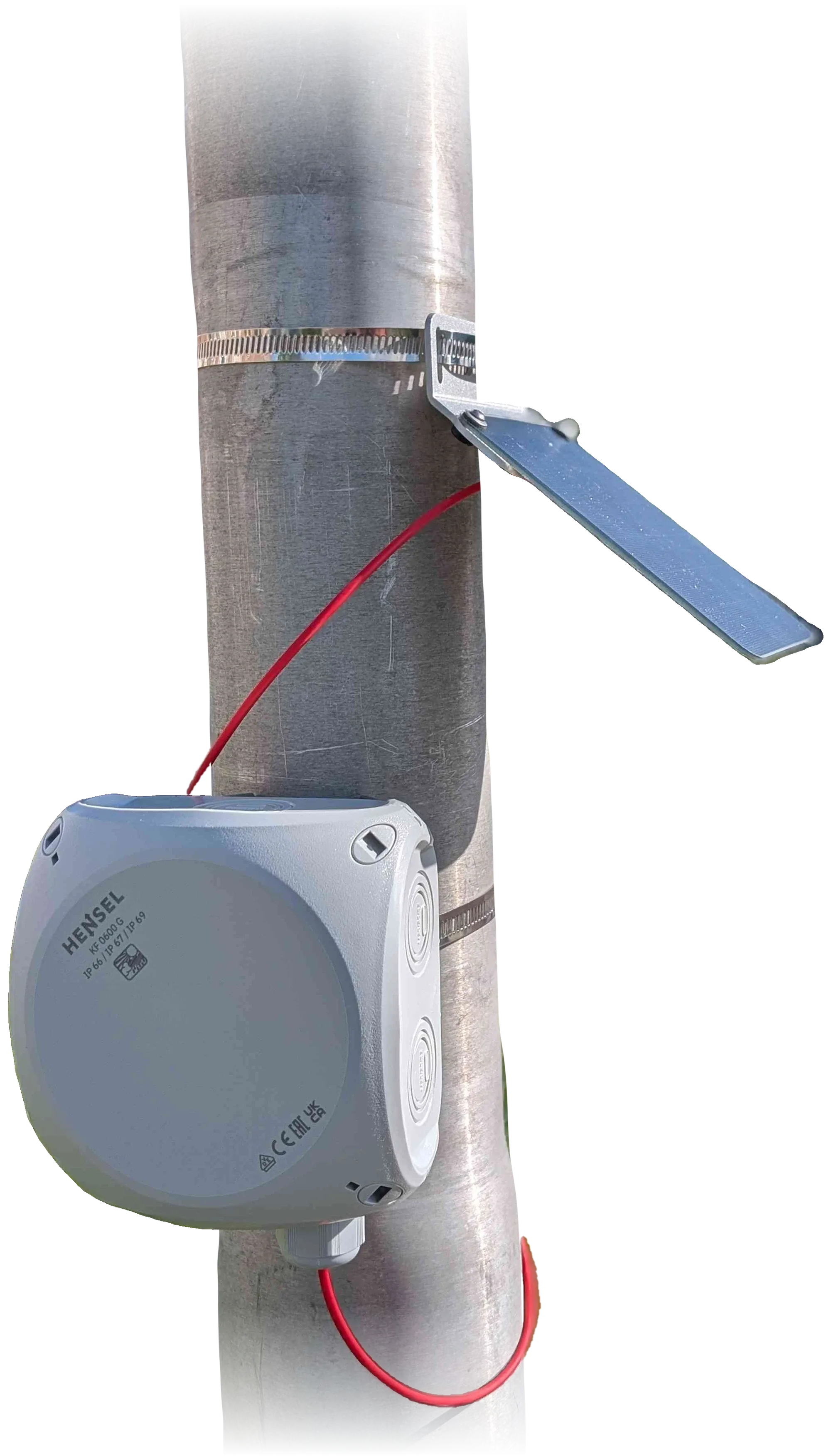
The reflexa micro unit.
Photo: TAHMO WLM.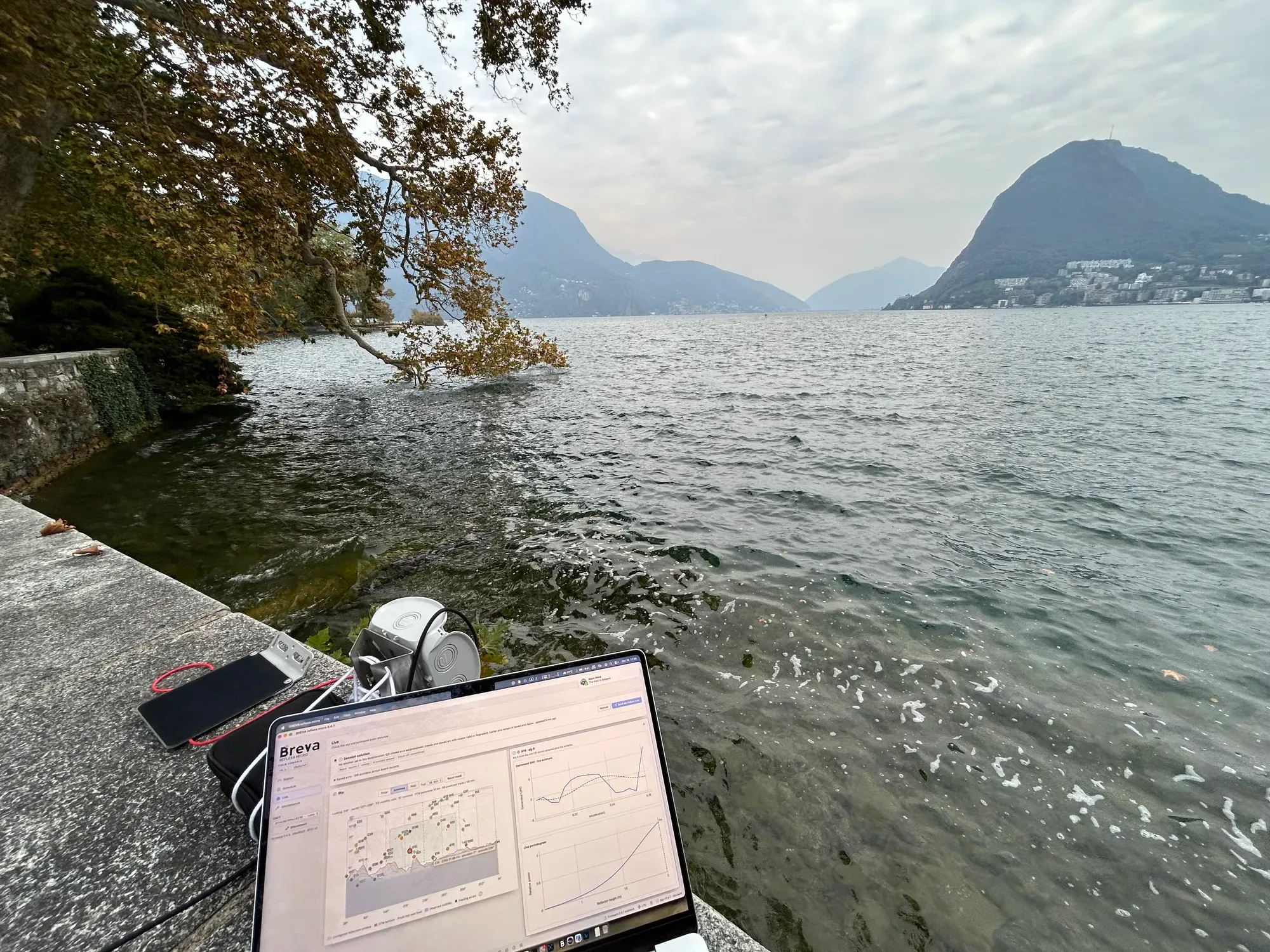
Test session on a lake-side wall: the unit and the field console showing the sky view and signal strength.
Who it is for
Section titled “Who it is for”- Hydrological and meteorological services that need water levels of lakes, reservoirs, rivers or coastal water at remote sites, and want gauges that floods and silt cannot destroy.
- Station networks (for example TAHMO) that want to add a dedicated water-level gauge next to their stations.
- Early-warning and climate-adaptation projects that need many affordable gauges across a basin, or on remote and glacial lakes reached only by satellite. A reflexa micro unit gives the level trend, not a real-time alarm.
- Owners of small reservoirs, irrigation basins and ponds, too small for satellite altimetry, who need a daily centimetric level.
- Dam and reservoir operators who want a level independent of the existing gauge.
- Researchers who need a cheap, non-contact gauge to complement or check traditional ones.
Where water and structures must be watched continuously, or displacement must be measured, GReD runs reflexa, its reflectometry service, on the larger GeoGuard units, where every station that sees the water is also a level gauge: see what makes reflexa micro unique.
Typical uses
Section titled “Typical uses”- Lake and reservoir level (the best case: calm, wide water).
- River stage at a bank or a bridge, where the water surface is wide enough for the reflection footprint (see site requirements).
- Coastal and tidal water level (slower changes are easier; fast tides need short arcs).
- Exploratory surveys of a new site with the autonomous Campaign mode.
Key features
Section titled “Key features”On the unit
Section titled “On the unit”- Multi-GNSS reception: GPS, Galileo, BeiDou, GLONASS, QZSS (SBAS optional; off in new configurations), 1 measurement per second.
- GNSS interferometric reflectometry computed on board: signal-to-noise (C/N0) tracks of every satellite rising or setting over the water inside the configured azimuth sectors and elevation window, arc detection, detrending, spectral analysis (Lomb–Scargle periodogram), quality control and a reflector height (RH) per arc; a robust combination per session.
- Elevation crossing times recorded at 1 Hz, so the height is not biased by the receiver’s whole-degree elevations.
- Automatic reflector-height search range: the unit finds the water and, if needed, moves its own search band (and reports that it did).
- Automatic station position from its own receiver; a unit moved more than 100 m notices and corrects it.
- Scheduled sessions (from short daily sessions to continuous recording), with an energy, storage and airtime estimate before saving.
- Persistent result storage on flash (about 7,300 records), kept across resets and firmware updates; running-buffer or stop-when-full policies.
- Iridium telemetry with a compact, versioned message format: the default message (session summary + unit health) is about 22 bytes, under the 25-byte minimum billed by the airtime provider.
- Flexible sending: never (store only), at the end of each session, every N results, every N hours, or a daily time; at most N messages per day; automatic retry. Sent results stay on the unit until downloaded.
- Experimental autonomous Campaign: one bounded measurement run per power-on with automatic position and range, ending with a satellite report — for a quick survey of a site without a computer.
- Robustness: internal and external (TPL5010) watchdogs, hang forensics, battery guard that keeps the radios off on a low battery, results saved before every requested reboot, no data lost on a firmware update.
- Three status LEDs that tell the state without a computer.
In the field console
Section titled “In the field console”- Two modes: Normal (Station, Schedule, Live, Sessions, Maintenance) for installation and routine work, Advanced for every setting and diagnostic.
- Site planning on a map: azimuth sectors drawn toward the water, ground footprint and first Fresnel zones, terrain horizon from a digital terrain model, offline lake shorelines (optional global map data pack), OpenStreetMap water, satellite tracks predicted for the next hours.
- Live verification: sky plot, signal strength per satellite, active arcs, and an inspector per satellite with C/N0 against time and against sin(elevation), the detrended oscillation, a live periodogram and a wavelet scalogram.
- Sessions workspace: every session and arc the unit reported, current water distance, exports (CSV/JSON), recovery of history after a restart.
- Iridium page: what the unit would send next (exact bytes, size, cost), the transmit queue, a decoder for messages pasted from the Cloudloop console (reflexa micro formats and TAHMO/Tiger packets), “send now” with confirmation.
- Guided firmware update over USB with checks before and after; firmware and app updates offered from the release channel; checks of the modem without paid traffic.