

Specifications
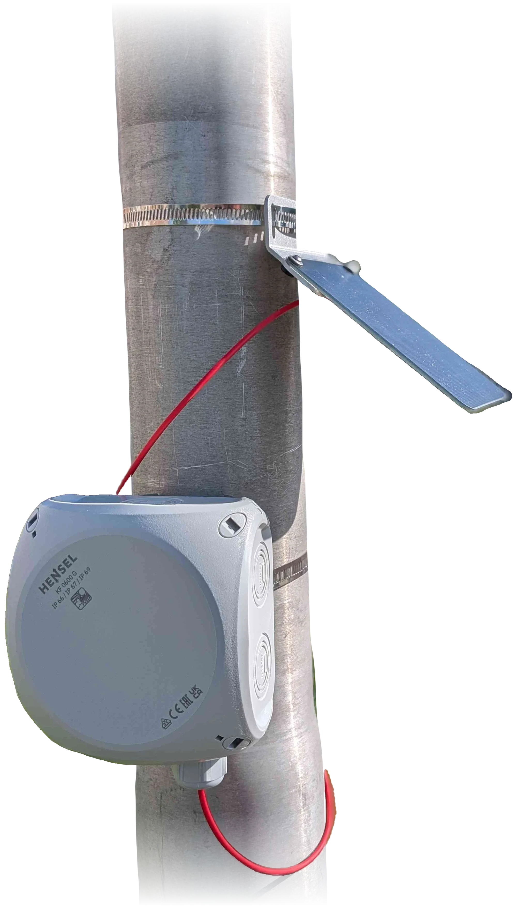
The unit: solar panel, enclosure and solar cable on a pole.
Photo: TAHMO WLM.Measurement
Section titled “Measurement”| Item | Value |
|---|---|
| Principle | GNSS interferometric reflectometry (C/N0) |
| Quantity | Antenna-to-water distance (reflector height, RH) |
| Precision | Centimetric per session (see Precision) |
| Typical antenna height | 1–10 m above the water |
| Elevation window | Configurable; 5–45° recommended with the low-cost antenna (Campaign: 5–25°) |
| Reflector height range | Automatic (from the elevation window) or user band; typical 1–30 m; self-correcting |
| Arc capacity | Up to 32 concurrent arcs, 4,096 samples each |
| Processing | On the unit, per arc and per session |
| Item | Value |
|---|---|
| Board | TAHMO WLM V1: RP2350A (dual Cortex-M33), 4 MiB QSPI flash (W25Q32) |
| GNSS receiver | u-blox SAM-M10Q, integrated patch antenna, L1/E1/B1 single frequency |
| Constellations | GPS, Galileo, BeiDou, GLONASS, QZSS; SBAS optional |
| Measurement rate | 1 Hz; C/N0 sampling interval automatic (bounded by the RH range and constellation) |
| Result storage | ~7,300 records on flash, up to 10 arcs per record |
| Satellite modem | Ground Control RockBLOCK 9704 (Iridium IMT, topic 244) |
| Telemetry message | ~22 B default (summary + health); +~13 B with position; per-arc results optional |
| Sending | End of session, every N hours, every N results, daily; daily maximum; automatic retry |
| Power | LiFePO4 26650 cell (~3,000 mAh) with solar/USB charging (BQ25176M, 500 mA, 0–60 °C) |
| Protection | Battery guard, internal and external watchdogs |
| Interfaces | USB-C (CDC serial, firmware update via RP2350 bootloader) |
| Power switch | Toggle switch; green LED blinks every 5 s when on |
| Operating temperature | −20 °C to 60 °C (TAHMO figure); solar charging stops below 0 °C |
| Status indication | Three LEDs (red, green, blue), readable without a computer |
Field console
Section titled “Field console”| Item | Value |
|---|---|
| Platforms | macOS (Apple silicon), Windows x64, Linux (Ubuntu 22.04 and later) |
| Offline maps | Global lakes pack (optional), terrain, OpenStreetMap water |
| Updates | Guided firmware update with backup and checks |